 EPIC Adventures for a Cause 2020 - originally was SC2SF but it really ended up being a random collection of crazy fun paddles. Come along for a recap of the fun.
Another year, another stretch of new coastline to explore in my forever quest to explore the entire California state. This year, the plan and finishing route were nothing alike. In fact, for the days and hours leading up to it, we almost didn’t even go. You see Santa Cruz is one of many areas dealing with major fires. Families evacuated, homes and state parks burned, roads closed, and air quality bad enough to cause people to avoid being outside at all. So you can imagine our struggle of going up to the area for what was originally supposed to be a three day paddle from San Francisco to Santa Cruz. Would we take hotels from evacuated families, crowd roads that were needed for emergency vehicles? Impose on folks in a time that people were struggling to keep positive. So for this Epic Adventure for a Cause, I want to direct people to the Red Cross for the cause. Please visit https://www.redcross.org/about-us/our-work/disaster-relief/wildfire-relief.html to see how you can help those impacted and even the first-respondors.
The night before my paddling partner for the trip Scott and I were still up in the air if we would go. The grocery trip was on hold, and while the car was packed, my wife and kids still weren’t sure if they would be shedding me for a week and partying or if I would be home and grumpy and feeling sorry for myself that I couldn’t put weeks of planning into action. The next morning though, Scott and I both decided we would give it a go. We would change routes, open up our palate to whatever coastline we could find that was safe, breathable and had fun conditions, and if needed, help any paddle friends we knew up there that might be evacuating and could use a hand (and truck).
After a long drive Monday and a very late start, we rolled into Half Moon Bay at 9:45pm. After walking into the wrong hotel, (apparently we were so road weary we didn’t check the reservation correctly), we finally found our spot to rest our heads. We spent an hour getting our gear in ready position so that the next morning before the sun came up we wouldn’t have to think of what goes where.
Paddle Day 1

This day was supposed to originally go down the coast, North to South. But Scott said his Windy app and scouting indicated we should flip the course. More than one local gave us the crazy eye. Just the day before conditions were typical (blowing south and onshore). So the idea of heading up the coast, with the ama facing swell and normal currents from Alaska sounded pretty crazy. But as we geeked out on the data, it seemed true, that running from Half Moon Bay north to Crissy Field in San Francisco would be a better route based on 10-17 knot winds from the south and a flood tide early afternoon to carry us in. I trusted Scott. He is a wind fiend and weather junky. He played as a kite-surfer for years in the bay area, sailed, and while newish to outrigger, has raced SUP in some of the windiest conditions I have tried in a canoe. Knowing he would be suffering alongside me with a bad decision, made me feel better.
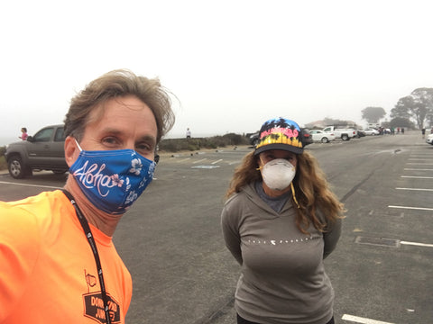
[ Stephanie Siaris greeting me at Crissy Field as part of the Shuttle Star Team ]
We woke up early that morning and dropped Scott and the canoes and gear at Half Moon Bay where I then drove up to SF to meet the amazing Stephanie Siaris. Stephanie is a real stud paddler, and as friendly as anyone up there (to that point everyone up in the Bay Area paddle community is beyond friendly. But more on that later). She and I greeted with facemask and air hugs (covid has changed greetings but the appreciation of seeing cool people never declines), and I left my truck at Crissy so she could shuttle me back down to HMB. She proceeded to drive down the coast and point out various hazards, beaching spots, and landmarks that us out-of-towners are so eager to learn about. Paddling new coastline is exciting but also daunting. You don’t know if that headlands ahead of us is the finish or just a false hope peninsula. I had done extensive reach outs to many amazing people to learn as much as we could of areas we’d be traveling along.

[ Staged and ready to head off into the fog of Half Moon Bay ]
When we got to Half Moon Bay, the pea soup fog was still there, but it was starting to improve slightly. We could at least see 100 yards or so, whereas when I woke up we couldn’t even see the car in front of driving us. Paddling in the fog in known areas is already sketchy. To do so in a new area, with hazards like sea mounts, surf breaks like Mavericks, and all sorts of huge cliffs to wash up on is a difference level of sketch. My journey last year down Big Sur my paddle friend Priscillia and I on one day encountered some visually debilitating fog. It can be disconcerting, but your senses read the water and clues appear. That said, last year and this time, technology played a huge role in our safety. This year I was using a fancy new Garmin GPS device that helped me always know my bearing, location, and distance from preset waypoints. It kept us on course and always aware of our location. What would have been ill-advised with minimal visibility was actually much safer. Scott and I were freed up to think about other things. Like paddling in super sharky water. Past world re-known deep-water surf breaks. Tackling 32 miles. Oh and making sure we took a course that would harness the wind and tide most effectively. And to Scott’s credit, we nailed that last portion. He had us aiming way off shore, up to 5 miles by the time we got to Pacifica so that the early morning wind form the south would help us into the gate as it turned on-shore by midday. What started out as surfing our canoes left with every ripple eventually became a downwind junkie’s dream. And also, kept us from getting pinned inside along Ocean Beach with onshore ama side 18 knot winds.
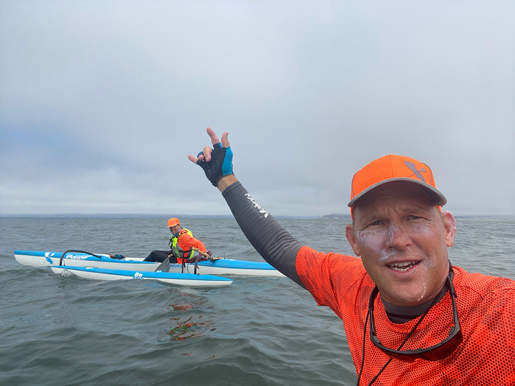
[ First Sight of the Golden Gate. Ocean Beach in the background to the right about 5 miles off. ]
After taking breaks every hour, and always in conversation speeds of 5.5 to 6.25 mph for the first two hours, we started noticing the wind really getting hot n heavy. Whenever one of us got hungry we’d stop and take a quick break. But our speeds was always side-by-side. Never catching a wave to get to far apart. Plus we are both pretty comparable paddlers which kept us from ever being too far to communicate. As we got to the mile 22 mark we started to see the Golden Gate bridge in the fog. It was a site to see. I imagined what it must have been like for sea-farers over the years to be welcomed by such a site. I had only seen it from the land side from the east. But this view…it was special. After seeing nature’s glory all day with jelly fish, sunfish, sea lions and seals, it was this man-made structure that really hit home.
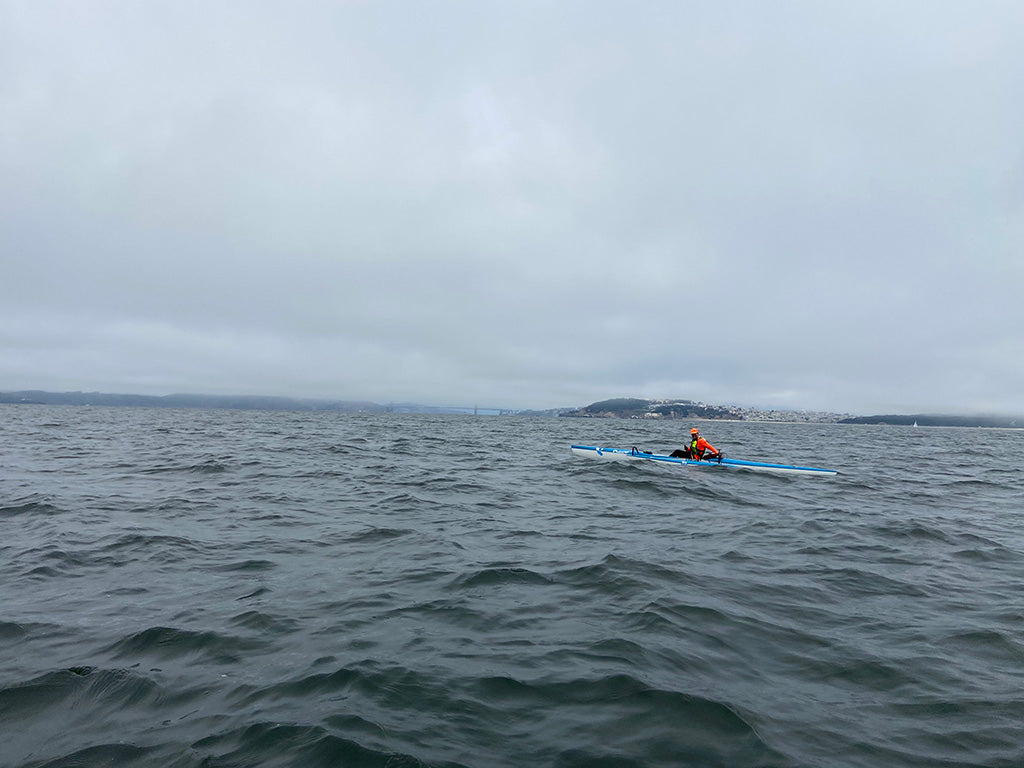
[ The moment we finally lined up to head with the wind and tide to the Golden Gate ]
One of the tips Stephanie told us was that the current can sometimes wrap north through the gate so to be aware since our destination would be on the right south side of the entrance after the bridge. I was hesitant to keep our distance out so far, but despite seeing the bridge we still had roughly 8 miles to go (7 north-east to the bridge and 1 mile past the bridge to the car), and Scott was adamant that we keep heading north. He wanted to fully get the onshore wind and big flooding tide to line up for a sleigh-ride into the gate. In fact, when we got lined up with the entrance outside the gate several miles, he suggested we paddle into the wind a little bit and out to sea and north more to let things fill in and see what we had to work with. And I thought I was the crazy one on this journey! We turned out after a little break and into it. We kept an eye on the shipping lane and repeated to each other Stephanie’s advice to always look over your shoulder for the silent fast moving boats that come in and out of the bay. After a little while, and 26 miles of paddling on the water, with a whipping wind, flooding tide, and clear blue skies ahead, we throttled the engines of our Pueo outrigger canoes and hammered in. Some personal speed records were going to be broken that day. If not, we’d probably have turned around and gone again.
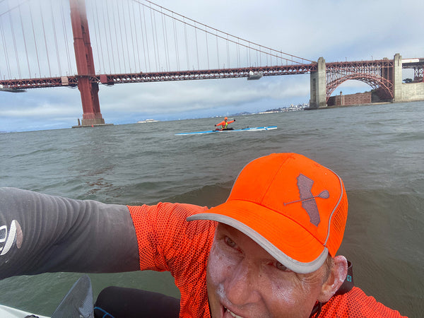
[ Mile 29, fresh off our fastest splits of the day and almost finished. ]
Luckily, the speeds we attained were pretty amazing and didn’t require any more foolish paddle detours. In fact I have never had sustained speeds in an oc1 like I did for the next 4 miles. It. Was. Unreal. My watch was showing speeds I only get when surfing breaking waves. That said some of the troughs we were flying into were just short of breaking waves. They were awesome. We were darting left and right, picking off steep sections and hooting and hollering for each other the whole time. At one point I did a 7:02 mile, breaking my previous PR of 7:24. But disappointed I couldn’t get just 2 seconds faster. So the next one we hammered like never before, starting and finishing side by side. My time? 6:38! After pausing to celebrate, and pinch ourselves to make sure we weren’t dreaming we took a bunch of pictures as we were just in front of the bridge. We then headed in, almost getting sucked into the tower, but again Stephanie’s advice came to fruition to be hyper aware of that happening and were able to avoid colliding into it. Then we found ourselves a crazy strong eddy where the water was circling and going back out. Our speeds plummeted but we still were surfin like crazy. Just slower and steeper. Kind of like the Gorge. We eventually got to our beaching spot at Crissy field and were greeted by two masked angels Stephanie and Jody Cox. They had food and beer and couldn’t wait to hear about our adventure. We took a long time to pack up that afternoon. We wanted to soak up the experience and share the great vibe with our friends. And the stoke was too goooooood to rush.

[ Post paddle grindz courtesy of Jody! ]
Paddle Day 2

Originally, we were supposed to paddle from HMB to Pidgeon Point Lighthouse the next day. The aforementioned fires though were pretty horrible. In fact the Highway 1 was closed for much of this stretch, and our destinations to stay in two spots were evacuated. So the days and night before, I had been reaching out to locals about what lay north of the golden gate. There was another fire up there, the Woodward fire that had closed off parts of Point Reyes. But south of there, the town of Bolinas was a possible launching spot. The wind, per Downwind-Junky Scott, looked pretty amazing if we launched there and kicked out 2-3 miles before turning south. So we planned this time to do just that. We waited until afternoon and were going to do a Bolinas to Mill Valley run. A giant U-shaped course, down the coast, into the gate, and up the bay to our hotel which was literally on the water.
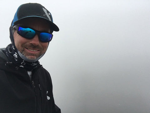
[ Spot check in the fog the morning of from Muir Overlook. Somewhere out there we'd be in 5 hours. ]
Our master of shuttle awesomeness and overall Rockstar this day came from Jody. I had the pleasure to have her play a huge role last year when my buddy Siam and I traveled up to explore and paddle the Big Sur coastline from Monterey to Morro Bay. Jody joined Siam as part of an amazing land crew that year, and I knew I could count on her to take seriously the point to point endeavors along stretched of coastline I have never paddled, and she was willing to help shuttle us. She even showed up with amazing food to start the journey and had food for us at the finish. Jody paddles to she knows how great things are after a long paddle, and she is as thoughtful as anyone I know. Scott and I were so grateful to have her on board with this day’s adventure. Again we masked up, did some car shuffling, and ended up at one of three possible launch spots. The first one, Stinson beach would have worked, but it was a bit exposed, and while not huge surf, a poorly timed set would end the journey before it started. We went to plan b, Bolinas Estuary.
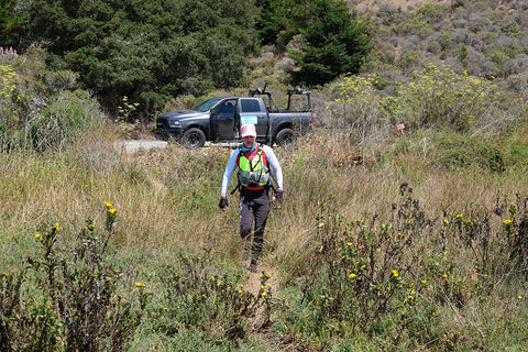
We found a spot along the road, and while the tide was not super high, felt we could launch at the southern end, notch a little extra exploration miles in this pretty estuary, then punch through the surf where it meets the ocean. We had another option of launching at the surf spot, but paddling through here seemed appealing. Until we got too shallow and had to walk our canoes for 5 minutes in sinking mud to deeper water while our huge surf rudders dragged long buried earth. But hey, adventure is not always glamorous. And I am sure the locals got a kick out of us.

[ 'Trying' not to sink in the mud or faceplant. ]
[Scott showing us all how to get into deeper water without shoving his paddle into the mud, and also how to wash off his shoes.]
[ Final strokes before we leave the calm and enter the fun. ]
We got to the ocean and surf spot, and Scott said the worst thing possible, “I haven’t seen it break to the right yet” as we started mutually veering that way. Sure enough an outside set came through into us. I was further out and caught it head on. It wasn’t too big though, 2-3 foot. Scott got over it as well without problem, and there we were, in the ocean, just south of the Bolinas headlands, heading towards, but south of some sketchy reef we’d been warned about, and about to exit the lee of the land that was protecting us from the onslaught of wind racing right to left from Point Reyes and beyond.
It was cookin! White caps everywhere indicated that we were going to have some help on this journey. Unlike the prior day where things started gradual in the ocean, this was full-afternoon-heavy. We paid the piper for 2 miles to get the angle right, and then we got impatient and agreed, “lets give it a go and test it out”. Just prior to that however, Scott had paddled by and stopped to look at something.
This stretch of coastline is not a place I would intentionally huli (flip) my canoe, drag my feet, or go for a swim. The man in the grey suit is present, and in part of the Greater Farallones National Marine Sanctuary, there are all sorts of reasons to fear what lie beneath. Especially for us wimpy SoCal kids. Scott and I have been paddling with Sharkbandz anklets (a highly magnetic band that deters the sonar of sharks) but let’s be real, I could be covered in those and still do my best to keep my dry side up as my cousin-in-law Adam says. I bring this up because Scott has stopped to observe a bird sitting on something. Not a kelp island, it’s a carcass. He was curious what it might be, seal, sea lion, whale etc. but as I pulled up, we both gave each other a look over, let’s not hang around this chum any longer than we have to. So we split! And fortunately, the wind got us far far far away in seconds!

[ At Muir Overlook the morning of Day 2, getting the lay of the land looking down towards the water and hazards during a brief clearing of the fog. ]
So, the wind here had us surfing right vs. the prior day surfing left. We needed to stay off the coast, and kept angling offshore after each great ride. We were flying really good. We saw a headland in the distance, and then a further one way way far down. Not being familiar with the coastline, we weren’t sure which one was our golden gate entry. But we realized after an hour that the first one was Muir Beach, and we still had the next one to get around. Even the strong winds we were surfing couldn’t net us 14 miles THAT fast. Eventually though, we did get to the next headlands. Point Bonita Lighthouse was there. Scott was eyeing the cloud-line, wind line and various fog lines. We opted to stay inside and not go wide this time based on what we were seeing, and that ended up just fine. The water at Point Bonita was extremely nuts. Very bumpy. Rolly. Reverby. Reefy And overall a washing machine. I guess it's called the Potato Path. So when I wanted to stop and get some food and apply some Chamois But’r (if you paddle you get it), Scott talked me out of it as it was simply not a good place to stop. So we turned the corner at the Bonita Lighthouse, followed a fishing boat in along the left, and proceeded to surf our brains out again as we entered towards the golden gate.
Fast speeds all the way in, hooting for each-other again, and wondering how we got so lucky…again!

After the bridge we found an eddy again, this time along the north side by Fort Baker. Fun waves but slower for sure, and then we headed north towards Sausalito and Mill Valley.
Our plan was to paddle this direction the last 5 miles right up to our hotel parking lot which was right on the water. We knew there would be some wind component to it, but were hopeful it might funnel in the gate and chase us north. Buahahaahaha! We wished. Instead reality set in and it was time to pay the piper for the first 18 miles of glide and fun. A strong left to right ama side wind greeted us, racing down the headlands eastward towards the east bay. And we were crippled by its force, and crawled along at a speed half our normal pace. We each too turns tacking into it, losing our hats, had a huli on one break, and finally, with a mile to go the conditions eased on us. We saw a bridge ahead and knew our finish line was just on the other side. Scott casually mentioned that lower to the bridge buys the beer, and it was on. Two paddlers, taxed and tired suddenly spend the next 9 minutes hammering alongside of each other. When the time came to dig deep for the final stretch, we each had enough respect for the other to finish at the exact same time. The work had been done, no losers today.
We beached the canoes, changed into warm clothes and our amazing friend Jody rolled up with more food and cheers and support. She had tried to get photos of us from the golden gate bridge looking down but the timing didn’t work out. We were so stoked and grateful for all her help though that we didn’t worry one bit. She headed out shortly after, we loaded the canoes on the roof of the truck, and started planning the next day’s adventures.
Paddle Day 3

The original plan of paddling down to Santa Cruz was still not in the picture. We knew this would likely not happen, and had been content spreading the stoke northward the second day. But on this third day, the wind was non-existent. I am more than happy to grind out flat miles, especially if it means new coastline is attained. But I also am more than aware that after 55 miles despite them being great conditions, for two days, we might be unlikely to want suffering. So we did what any two paddlers might do with a huge state to explore, and our homes 8 hours south…we looked at the maps and found the best possible stretch we could between us and home, and hit the road. Santa Barbara here we come!
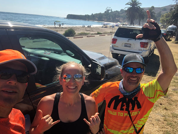
I put out a call to one of my favorite paddle peeps, Megan Phillips who lives and paddles in Santa Barbara. “Hey there! By aaaaaannnnnyyyyy chance would you be free this afternoon to help two wayward paddles with a little shuttle help?” If there was any hesitation in her willingness to help, I didn’t notice it. She ended up being the third shuttle angel for our adventure to help make some dream paddling take place. We dialed in logistics, and around 2:30 met up with her to shuttle/shuffle and help us launch at Refugio State Park around 3:50pm.
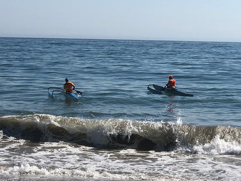
The familiar coastline, warmer water and air, and sunshine led to a much more comfortable launch than the previous two. Instead of fog, big fish and heavy winds, we were entering a protected channel between the coast and the numerous islands to the right. The conditions, per our app, were supposed to be pretty amazing from there to Ledbetter Beach. 23'ish' miles with arcing 15 knot winds perfectly aligned with our path of travel. But when we hit the water, about an hour later than we expected, the intended downwind felt sticky and an awful lot like a headwind. Our luck run out!
We found some great bumps and wind, but for whatever reason, there felt like there was a current pulling us backwards. Speedy waves that should have had us in the 6-8mph range had us in the low 5s! We realized pretty quick, this point to point paddle would take a little work. We took turns reminding each other how lucky “we had gotten so far”, and how “its all the apps fault”. There was one stretch at the halfway point at UCSB and campus point where conditions started to really light up for us. Back on our GPS watches were fast speeds and we took turns darting and dashing and hooting. But then, about a half hour later, the perfectly lined up swells lost the push from the wind we needed to catch them. And all we could do was watch them roll under us as the opposing current made its presence known again. We were back in the low 5mph zone, and at this point, the sun was just about to set, with 8-10 miles to go.
The good thing about paddling with a buddy, is that you know you have each others’ back. And situations which might be scary solo are simply a challenge when together. Armed with this wing-man mentality, plenty of food, water, emergency supplies and GPS communications, we paused to honor the setting sun, looked for a green flash, and went to work. It was grind time. After another 30 minutes, it was pretty dark, and we reached into our bags for glowsticks and beacons. Send a text message to family and friends letting them know we were safe and sound but running late. There was some fun little runners at this point, and the 2/3 full moon helped light our path as our non-visual senses of the waves and wind were heightened. We felt the breeze, heard the crashing, absorbed the splashes, and hoped, just hoped that around the next headlands in front of us would be our finish line. “I am pretty sure we are getting close” I yelled over to Scott, who was matching my effort to stay close to each other, and still avoid kelp beds. “ok good. Just don’t tell me we have to aim for those lights way out there” I looked way in front of us and sure enough far in the distance were some lights of a town. If we had to go that far we were really a ways from home. But I checked my GPS again and called again, “I am pretty sure we land before those!” Careful not to sound 100% certain, but also convey some confidence. Scott’s back was getting tight. My rear end was pretty chaffed, and as we came up on mile 80 for three days, I reeeeeaaaaally hoped I was right.

[ Our final path was lit by moonlight and glowsticks. ]
Another 15 minutes, the headlands got closer, and we turned a corner. We didn’t see immediate land and lights, but a glow around yet another point gave us hope we were close. Straddling the feeling of relief and disappointment we grinded on a bit more, another check on the GPS, and trying to remember if my GPS was set to land miles or nautical miles, and casually asking Scott, “hey what’s bigger?” He was still in good spirits, and chuckled that my recent only another mile might mean more than that. A fish jumped right next to us, and almost in my canoe. I silently wondered what caused him to jump. Then stopped wondering as quick as I could. Aimed for the next headland, and hoped the glow was a sanctuary.
Well, we finally got there. A beach I have paddled out of several times, and knew pretty well. But in the dark, had to make some assumptions. Megan had parked our truck by a lit restaurant area and we knew we were almost home. There is a shore break at this beach, and we vowed to very careful coming in, near each other but not too close. No point in ending our trip with a huli in shallow water and getting hurt or busting our canoes. So we sat outside the surf until the time was right. I felt (but couldn’t see) a wave come under me, and having timed them for a minute before, felt I had my window so I hammered hard to try and outrun any follow up wave. Apparently I didn’t hammer enough as I heard the rush of water, felt the lift of my canoe as it caught me, and struggled to hold my line as I came into the darkness that was the shore. Right as the canoe was about to spin on me. It all came to a stop. My canoe hit sand, I jumped off super fast to lift it up over the wave and sand, and catch my breath. To my right I saw the glowstick beacon that was Scott come in for a landing. He asked if I was ok, confirmed we both were. And hit stop on our watches. The adventure of day 3 was complete.

That night, we ate a ginormous burrito, ice cream, drank some warm beer, and celebrated a third day of sun and salt water. We acknowledged how we need to always be good with bringing gear as it had come in handy big time today (err tonight).
Paddle Day 4

The next day, was all about the drive home, retelling stories of our conquests and near misses. There was a little bit of wind in Oceanside, about 30 minutes north of home, and we decided to get one more quick paddle in and see if we could score some wind, surf or at the very least, prolong the reality that awaited us. It’s not often we can pull away for a week to explore. Throw plans out the window one day, and then follow them to a tee the next. Trusting each other, and our experience, but staying humble enough to throw our ego out the window whenever we had a chance to opt for a safe line, extra gear, or take a moment to assess the best course of action. No macho on this venture. We finished with 6 fun miles, 3 into the wind, 3 with it. 1 near miss as I almost surfed right into a big red buoy. Loaded up the truck and canoes one more time (we had gotten pretty good at it by this point), and headed home. 4 counties 1100 miles driven and 86 miles paddled. Tons of smiles, speed and nature. And doing our best to explore as much as we could in the window we were given on our trusty canoe steeds.
Denouement - The Paddle Community
This sort of trip was born many weeks before. And could not have happened without extensive expertise offered and shared by many locals and trusted watermen/waterwomen. I make it a point to pick the brains of everyone I can who might know spots I have never paddled. And this trip was no exception. I reached out to old friends, and through connections was introduced to new ones. Locals in NorCal were always willing to support my vision, offer their reservations and tips, and help out however they could. Our sport continues to remind me that paddling is a community. And anyone who ever travels is very lucky to have people help out. Special thanks and gratitude to Dave Loustalot, John Hadley, Will Rose, Kenny Howell, Shanna Upton, and Carter Johnson. These folks were instrumental in helping me understand the hazards I would be encountering. Offer tips and tricks. And basically make this trip happen safely. I even got tons of help on the NCOCA FB Group when we were looking at landing spots for a point to point late one night.
Also, another remarkable show of community, the shuttle stars Stephanie Siaris, Jody Cox and Megan Phillips were so appreciated. Your time, knowledge and enthusiasm for this most recent crazy journeys is heartfelt and very very appreciated. I am such a lucky guy. And with each paddle stroke I take, I am never alone in my canoe.
Never.
Team Writer Clarke Graves - If there is water, he will paddle it (regardless of craft). Clarke is a surfer turned paddler who grew up in San Diego but has traveled every corner of California enjoying its beauty and appeal. He has had the privilege of racing SUP, OC6, OC2, OC1, Prone, Dragon-boat and surf-ski.
One of Clarke's goals is to paddle as much shoreline in California as he can, with as many paddling friends who are willing to join him. If you have an idea for Clarke to write about or any questions, send it our way and we will pass it along!



Hapa Hammer - October 16, 2020
Have the privilege to know Clarke and paddle with him when he first started paddling OC6. You come along way for all the right reasons. Keep it up my friend!!